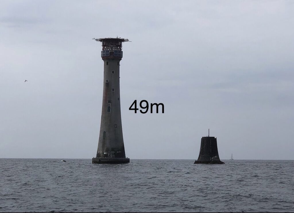
The Eddystone Lighthouse is an iconic maritime landmark located off the coast of Plymouth in the United Kingdom. It stands tall at approximately 49 meters (or around 160 feet) above the mean sea level. Now, when one is standing at sea level at Wyscombe Beach, the lighthouse can be partially obscured by the Earth’s curvature, especially its lower portions. This is primarily due to the distance between the beach and the lighthouse, combined with the fact that the observer’s vantage point is virtually at the same level as the sea.
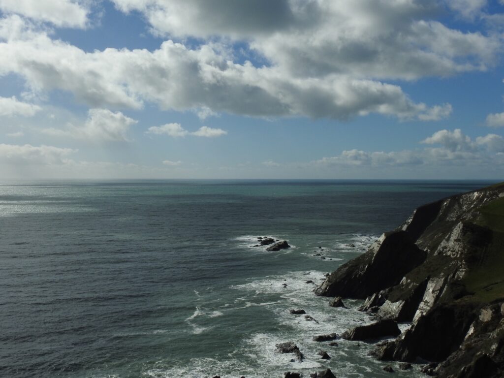
However, the cliffs near Bigbury offer an elevated vantage point. Depending on the specific location, the cliffs can rise anywhere from 20 meters to over 60 meters above sea level. When an observer is positioned at these heights, their line of sight dramatically changes. The higher altitude allows one to “see over” the Earth’s curve to a greater extent. Consequently, from the top of these cliffs, more of the Eddystone Lighthouse becomes visible, and depending on the exact elevation of the viewer, the entirety of the lighthouse can potentially come into view.
In addition to the Earth’s curvature, atmospheric refraction can further influence how the lighthouse is perceived from a distance. According to Snell’s law, light rays change direction when passing through media of different densities. Near the Earth’s surface, the air tends to be denser closer to the ground, gradually becoming less dense with altitude. As light from the Eddystone Lighthouse travels through this gradient of air densities, it bends downward. This effect can sometimes make the lighthouse appear slightly higher than its actual position, further enhancing its visibility from distant locations. However, this effect can vary based on atmospheric conditions, including temperature and humidity.
The data to observe accurately the curvature of the Earth.
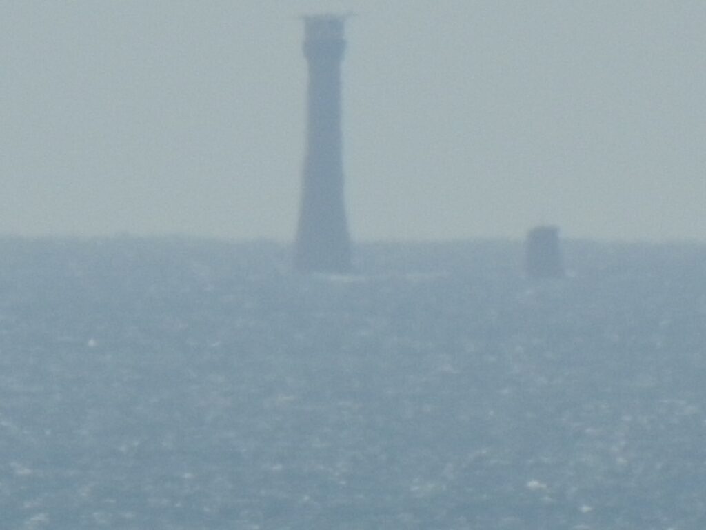
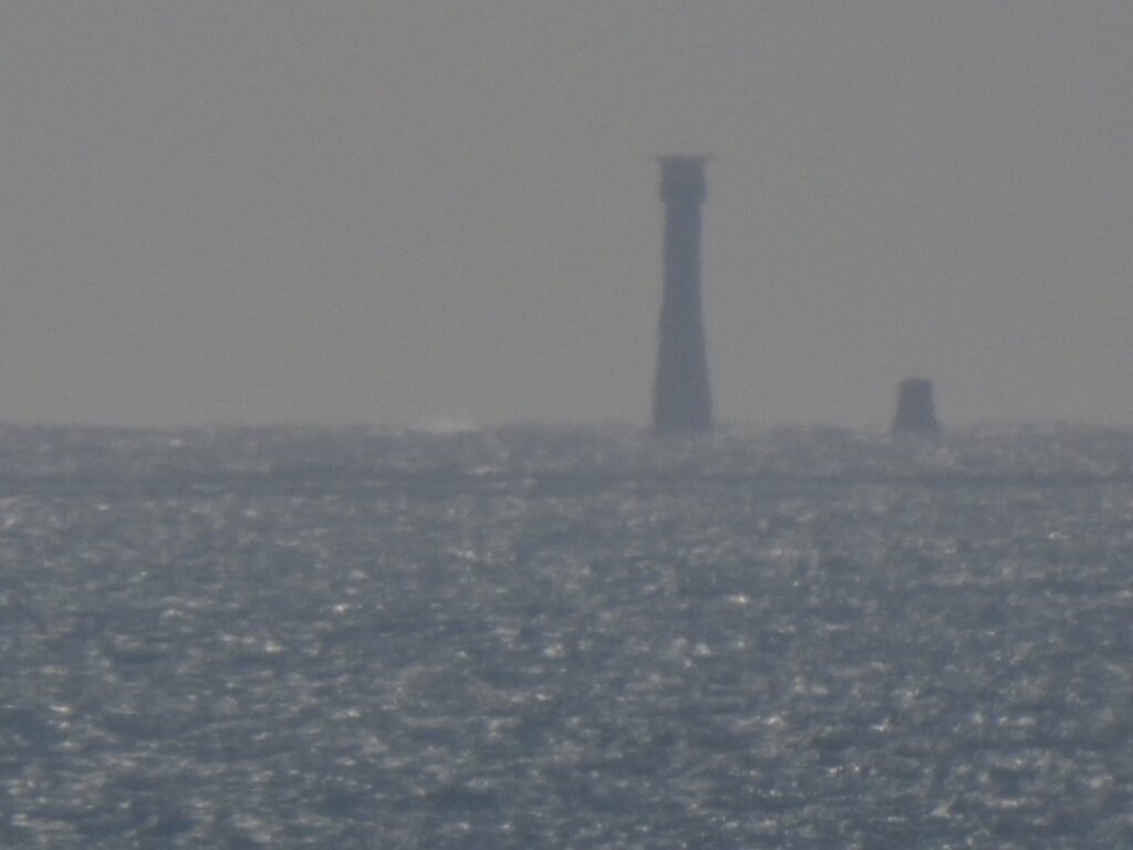
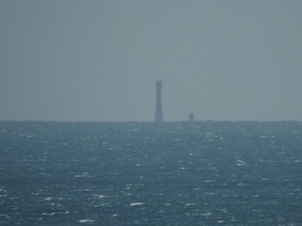
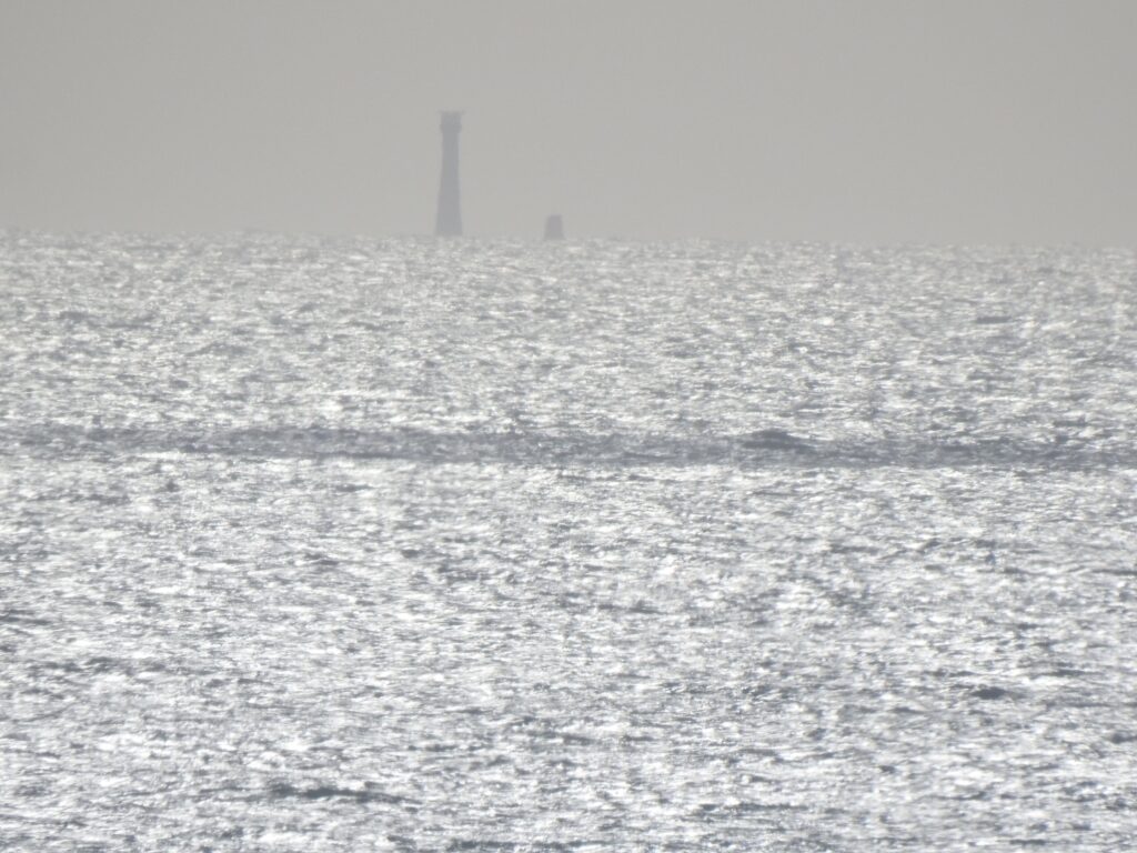
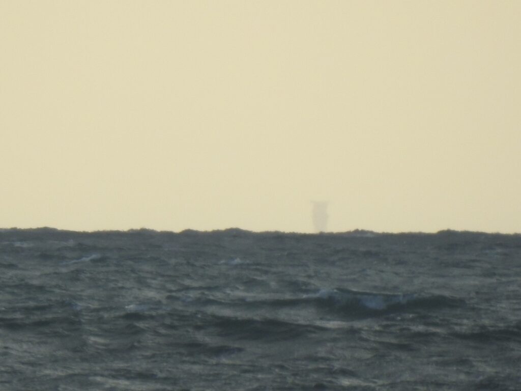
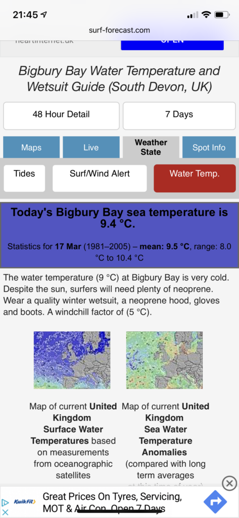
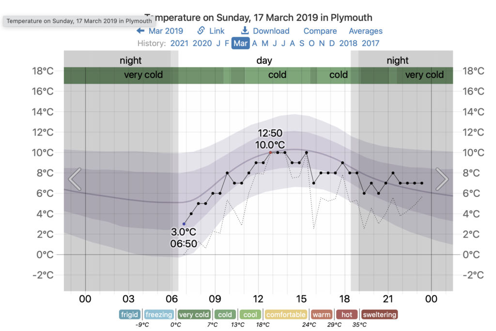
The series of photos below were taken by myself on 17th March 2019, as I walked down from the top of the cliffs (60m height) onto the beach (2m height), the distance from the lighthouse is 27km. The air temperature and sea temperature were almost identical on the day both hovering around 9°C, which meant that there was little refraction due to temperature differentials. Bear in-mind, this started as a normal family day out without the plan for such an experiment. It was only due to the lighthouse being visible that I recorded the shots. No tripod, a full zoom and a steady hand was all I had.
According to the maths, at 60m height we should be able to see all of the lighthouse and beyond. At 2m height, on the beach we should be able to see just 8m, with 41m being hidden behind the horizon. This is exactly what was seen and the images below are the evidence.
The swell was small, no large waves. The image taken from the beach gives the impression of large waves obscuring the lighthouse, whereas it’s actually the small waves on the zoomed in horizon.
Captured with a Nikon P900 camera at medium to full zoom.
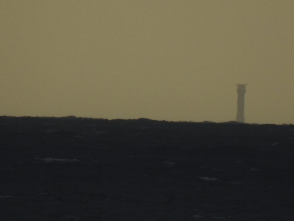
Some ask, why is the zoom different in the images. The reason for this was due to how difficult it was to keep the lighthouse in shot without a tripod, whilst moving over the cliffs. The starting image in the sequence, where you can see all of the lighthouse was 27km away and took up almost the full camera frame when zoomed in. Because it was bright in the sky, a fast shutter speed was able to catch it easily despite it being hard to keep in frame. As the day went on, as it was March, the afternoon dimness came quickly. By the time we had descended from the cliff, the daylight was far less.
To keep enough light coming into the camera to keep a sharp image, I had to adjust the zoom, zooming out enables the camera to capture more light. It has no difference in what you can actually see.
In conclusion, the combination of Earth’s curvature, an observer’s altitude, and atmospheric refraction all contribute to the visibility of the Eddystone Lighthouse from locations like Wyscombe Beach and the cliffs directly West of the beach. The dramatic coastal topography of this region, paired with the towering structure of the lighthouse, provides a captivating demonstration of these natural phenomena in action.
Given the temperatures on the day, with both air and sea temperatures within a single degree, there wouldn’t have been any meaningful refraction. This gives us the evidence of the Earths curve, with the lighthouse disappearing bottom first below the horizon.
No only that, the measurements/images also correlate very closely to the earth curve calculation to further back up the claim that the Earth has a curved surface.
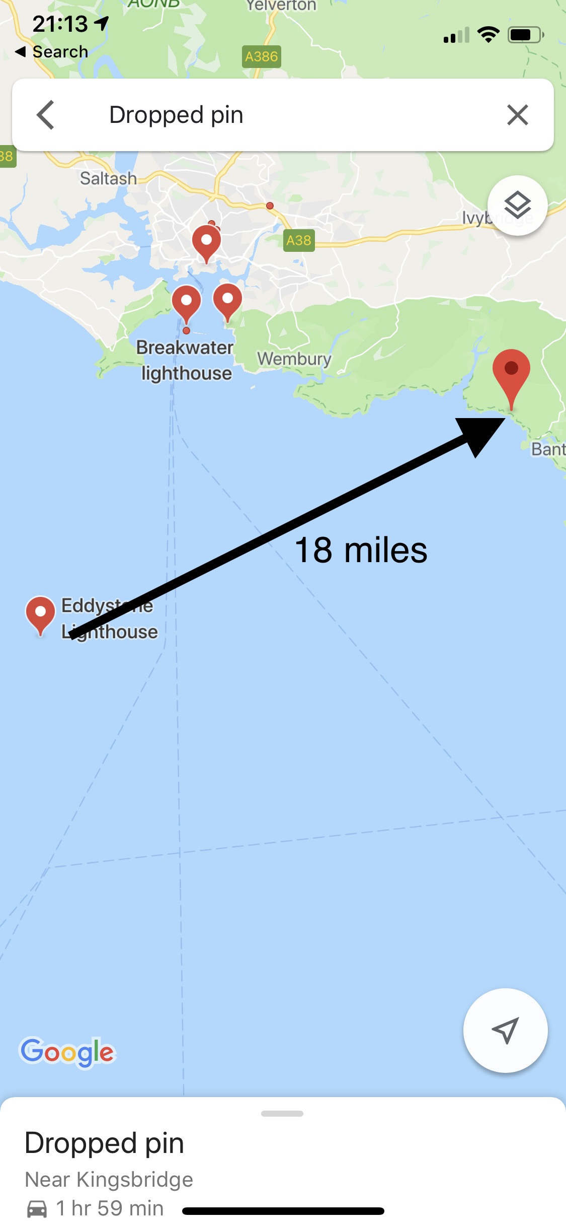
Try out the Earth Curve calculator using distances on the Google Map.
You can use the calculator below to test how much of an object would be hidden below the horizon based on the curvature of the Earth. This calculation assumes a completely spherical Earth which we know not to be true, it also does not take into account Snells law and the associated refraction caused by atmospheric temperature gradients, bending the light (viewable area).